
10/20/16
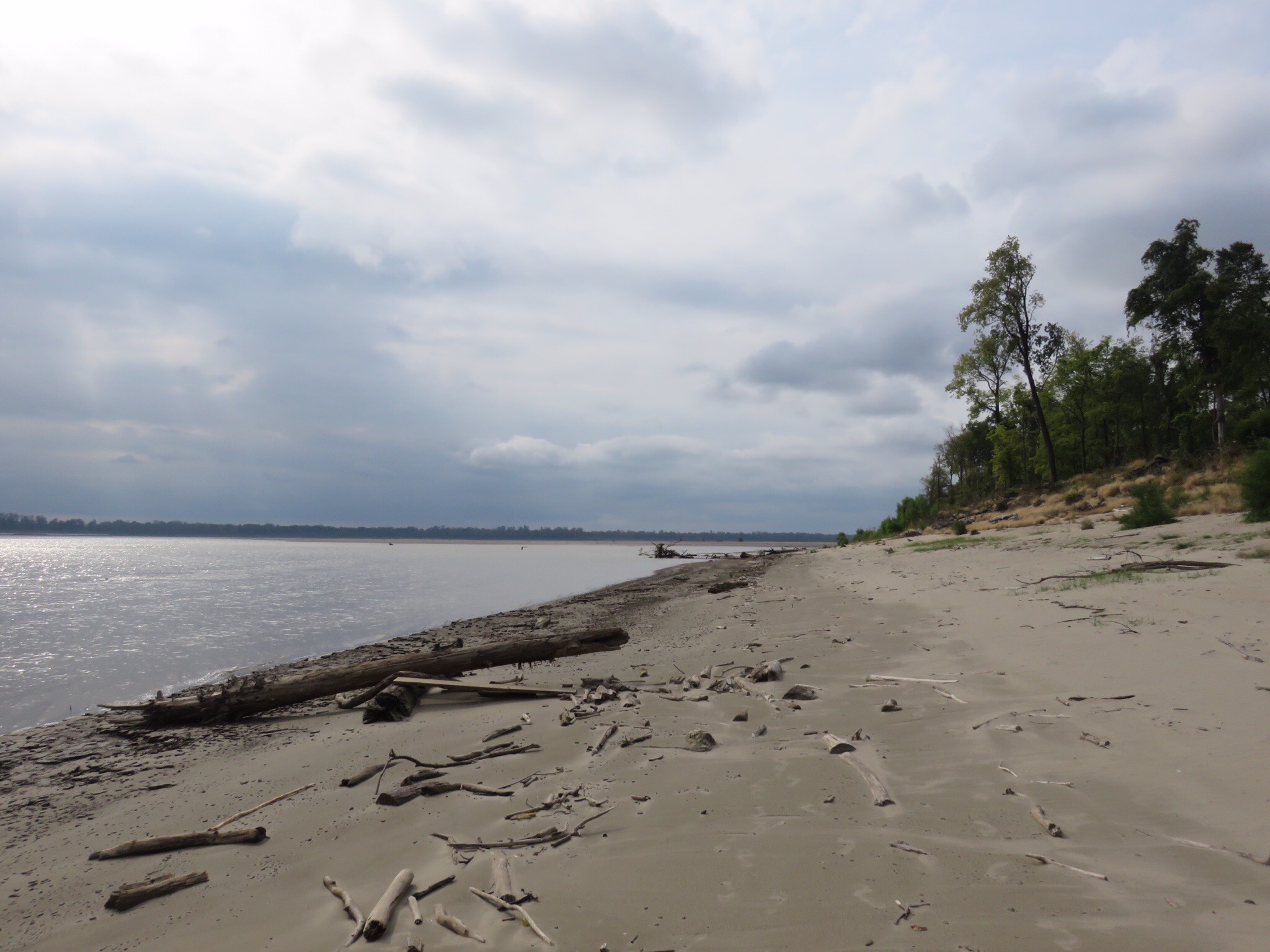
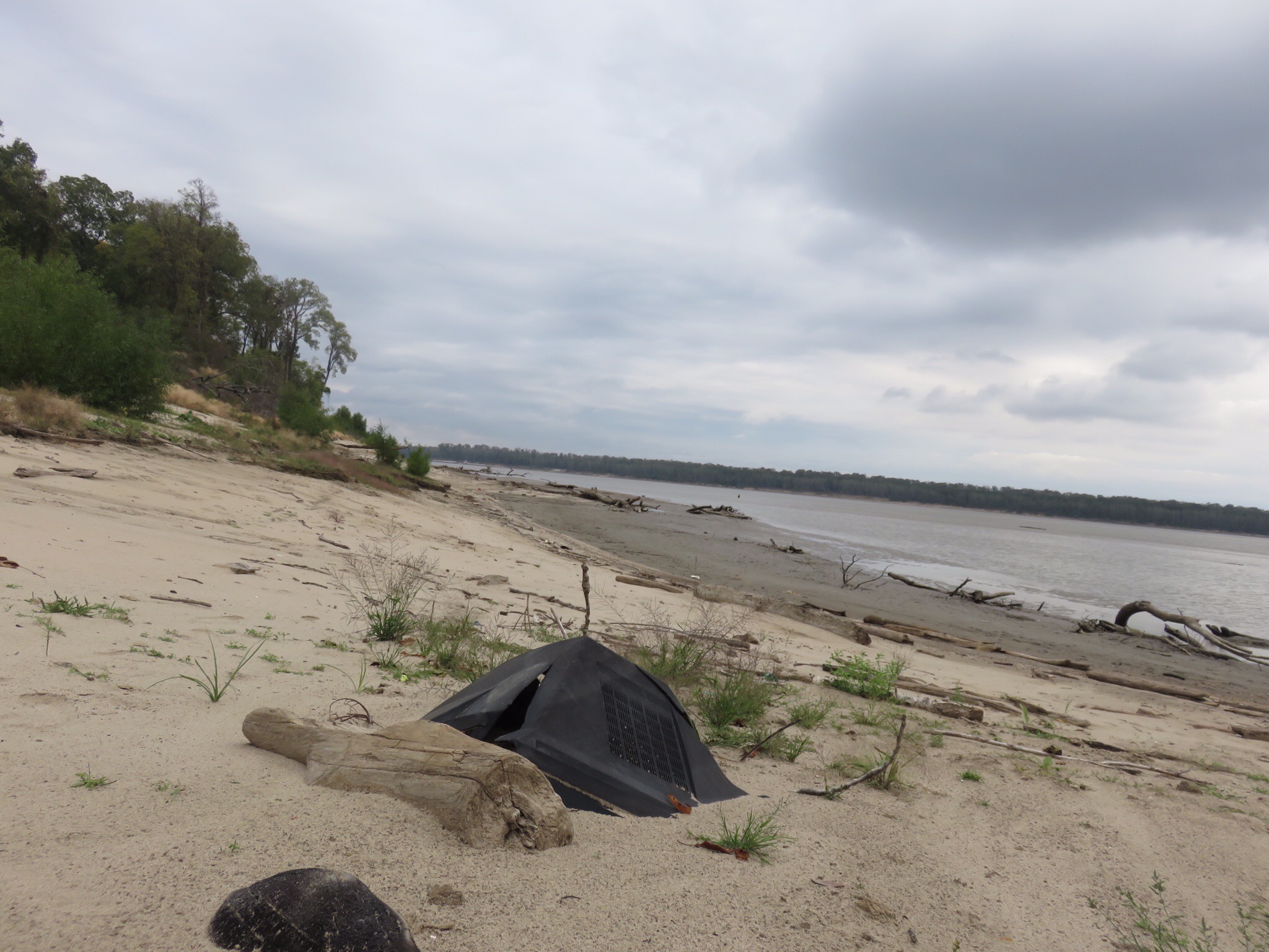
The sky is a steel gray. When the wind blows the ripples on the water’s surface seem angry. The air around is still, but not a calm still, it’s a weary still- a stillness I don’t quite trust. Then suddenly a gust of wind comes rushing around the corner bringing a swooshing sound as it ruffles the tree tops and pushes on my face. There is a tug and barge on the river in front of me that has stopped moving completely, despite being in the middle of the channel. It’s as though it is waiting for something, but what? I look down the beach to my right and see driftwood covered sand, knowing that beyond what I can see is a beach that continues around the point of the island. On this beach are footprints. So many footprints. Beaver, deer, coyote, mice, raccoons, pelicans, birds, and as of this morning, human. Kyle and I spent hours this morning exploring the beach. We began walking, rain jackets on, coffee mugs in hand, and headed south on the island. Exploring driftwood, garbage, mud, rocks, and the various footprints we strolled along enjoying the unknown. Each step, each turn around a bend providing a completely new and untouched area of land to experience. At one point we climbed up a small incline and I found myself sitting down on a smooth piece of driftwood looking in front of me on the sand. “Want to watch T.V.?” I asked Kyle, my tone somber and defeated as we looked at the large, black, plastic, and glass T.V. that had lodged itself upside down in the sand. Disappointed we sat on the log and didn’t talk for a few moments, words weren’t necessary.

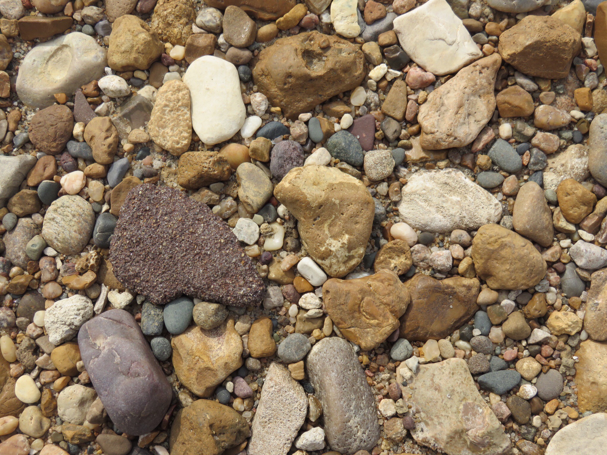
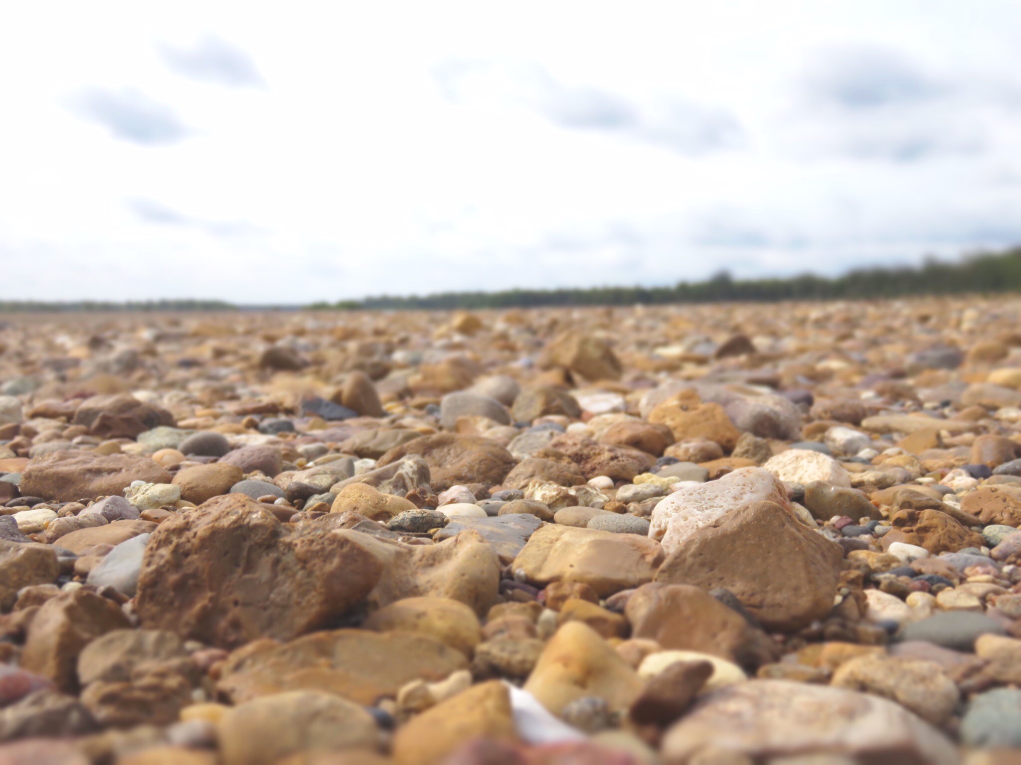
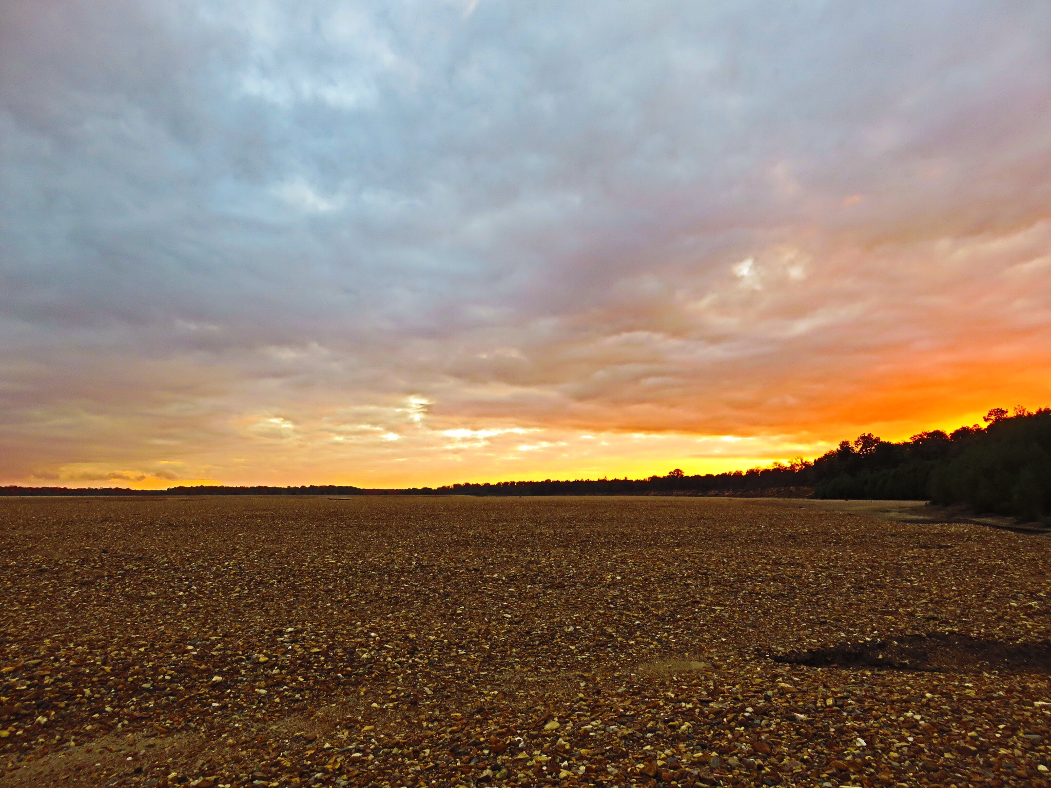
Continuing on we rounded a bend and were greeted with the most marvelous view of openness. A massive barren sand bar was protruding from the point on the end of the river’s bend. This sandbar though was blanketed in millions of stones and pebbles of all shapes and sizes, the majority of them being smaller than a clenched fist. Excitedly we scaled the steep edge of the shore before hopping down onto the enormous piece of land. Our bare feet, encapsulated in mud and sand, carefully guided us over the small rocks. For the next 2 hours we walked, a bit cautiously as the rocks were a bit harsh on our soft soles, and searched for treasures within the blanket of stones. Together we filled the pockets of my rain jacket fully with stones, pebbles, oddly shaped pieces of coal, and river glass. I found myself in complete awe of how absolutely raw, pure, and vast the area around me was. It was so massive that when I finally made it to the middle and sat down, I couldn’t even see the river; only blurry smudges of green in the far distance- trees marking the river’s edge. Kyle sat down next me and for a few moments our universe consisted of stones, pebbles, and the ever changing grey skies above. Small water droplets landed on our rain jackets and we watched as they marked the stones next to us, causing just a small stain on the rock’s surface before drying into nothingness. Once my pockets were full and my rain jackets much heavier than when we left, we began the cautious walk back to the muddy sand that would take us back to our camp. Kyle walked in front of me, turning around to laugh every once in a while at the music the rocks and river glass were making in my pockets as I trudged along.

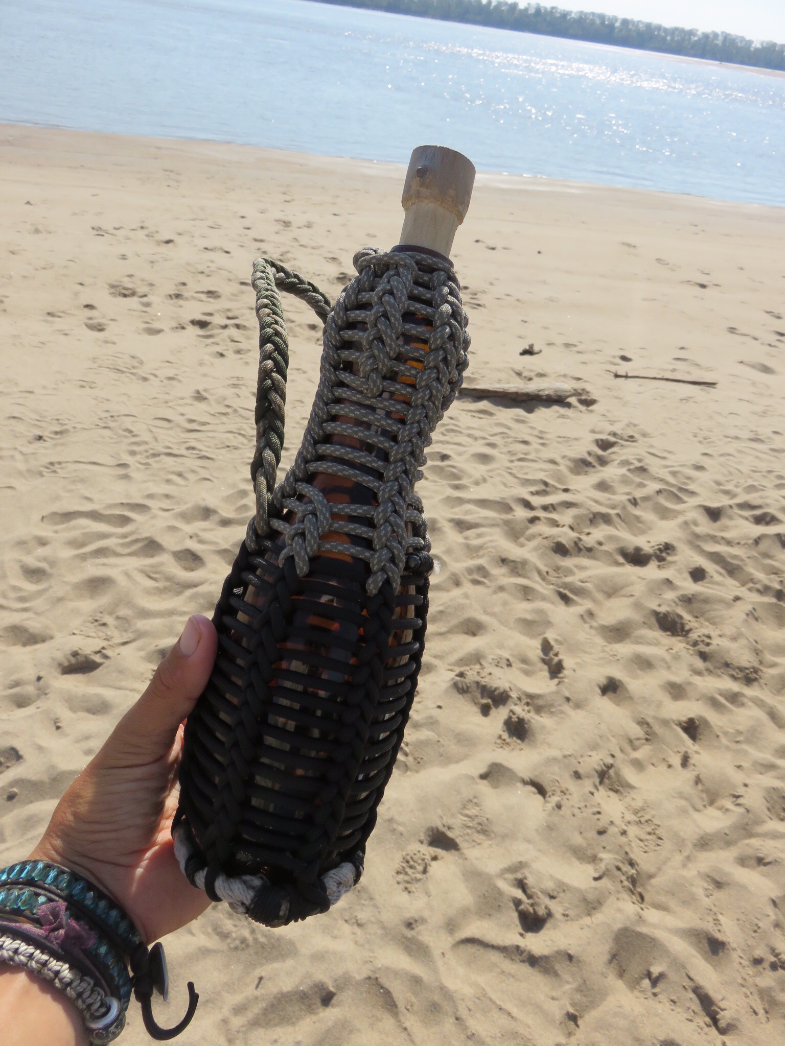
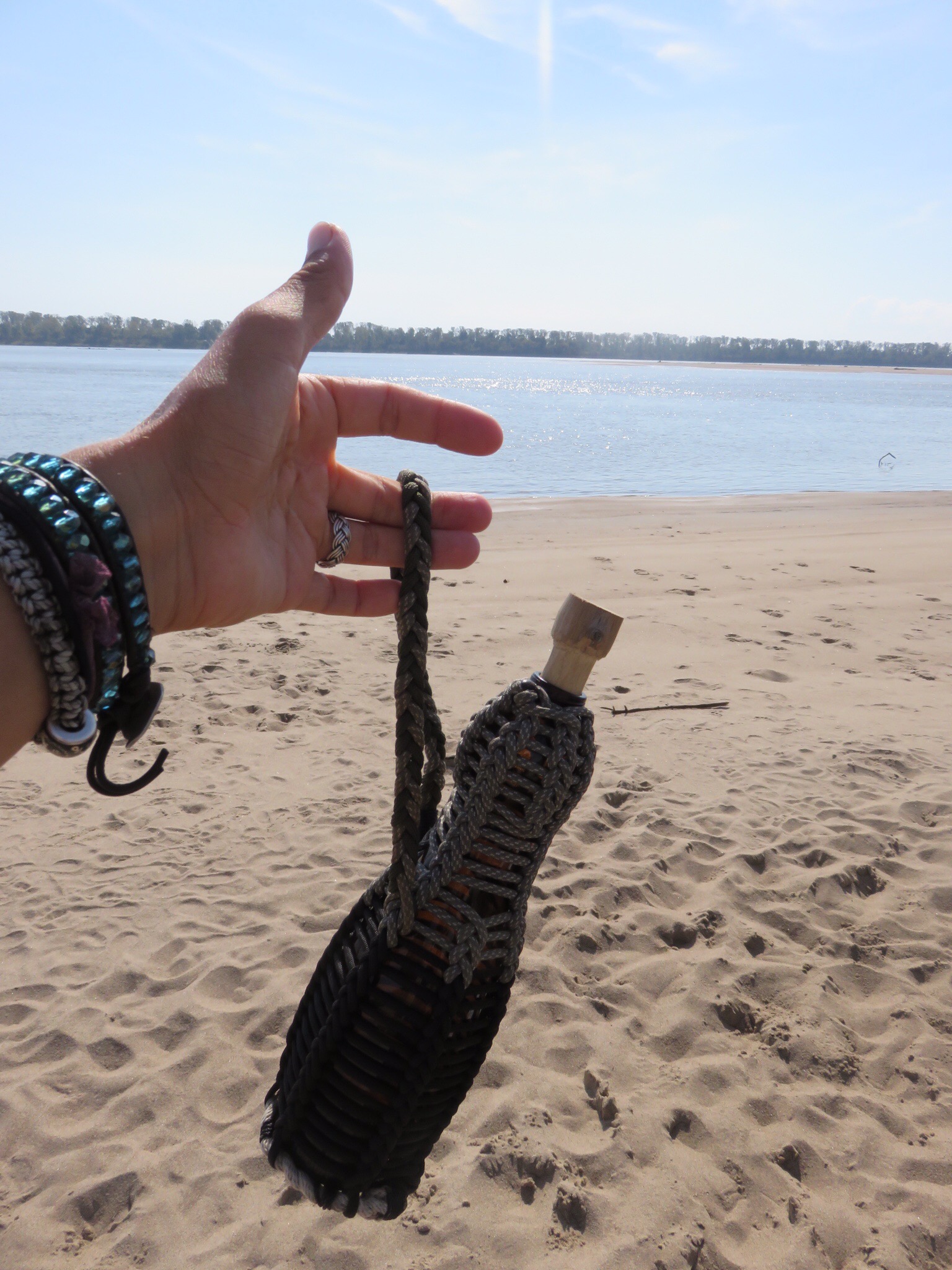
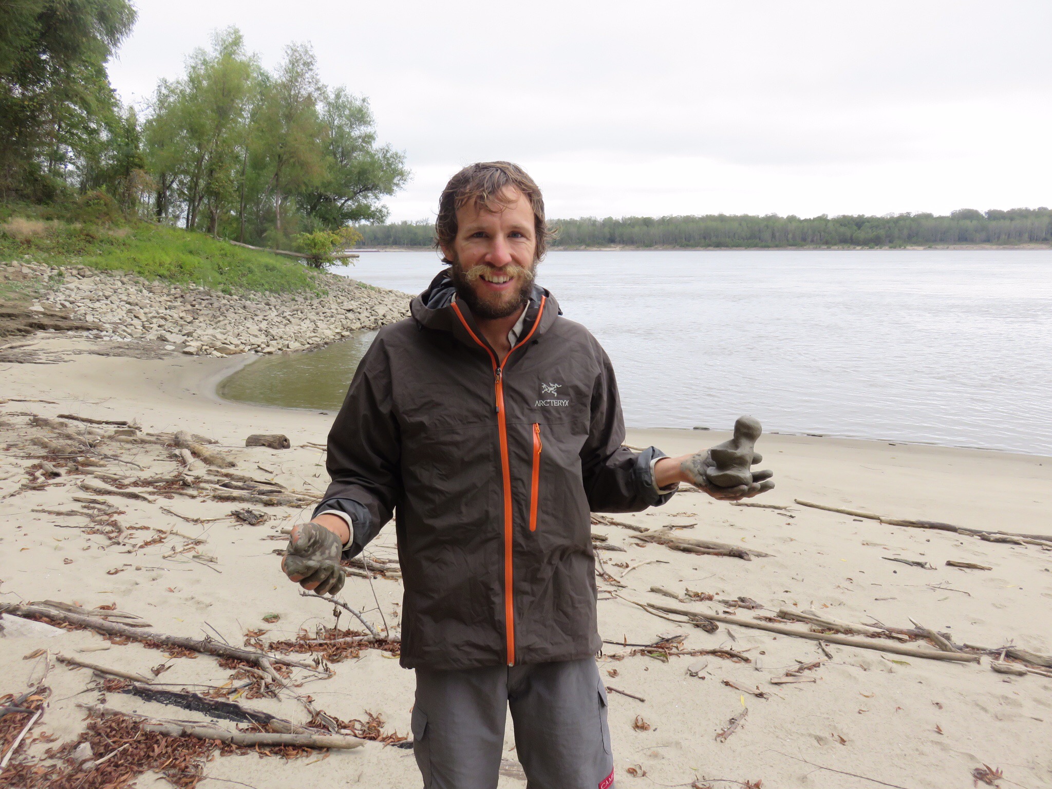
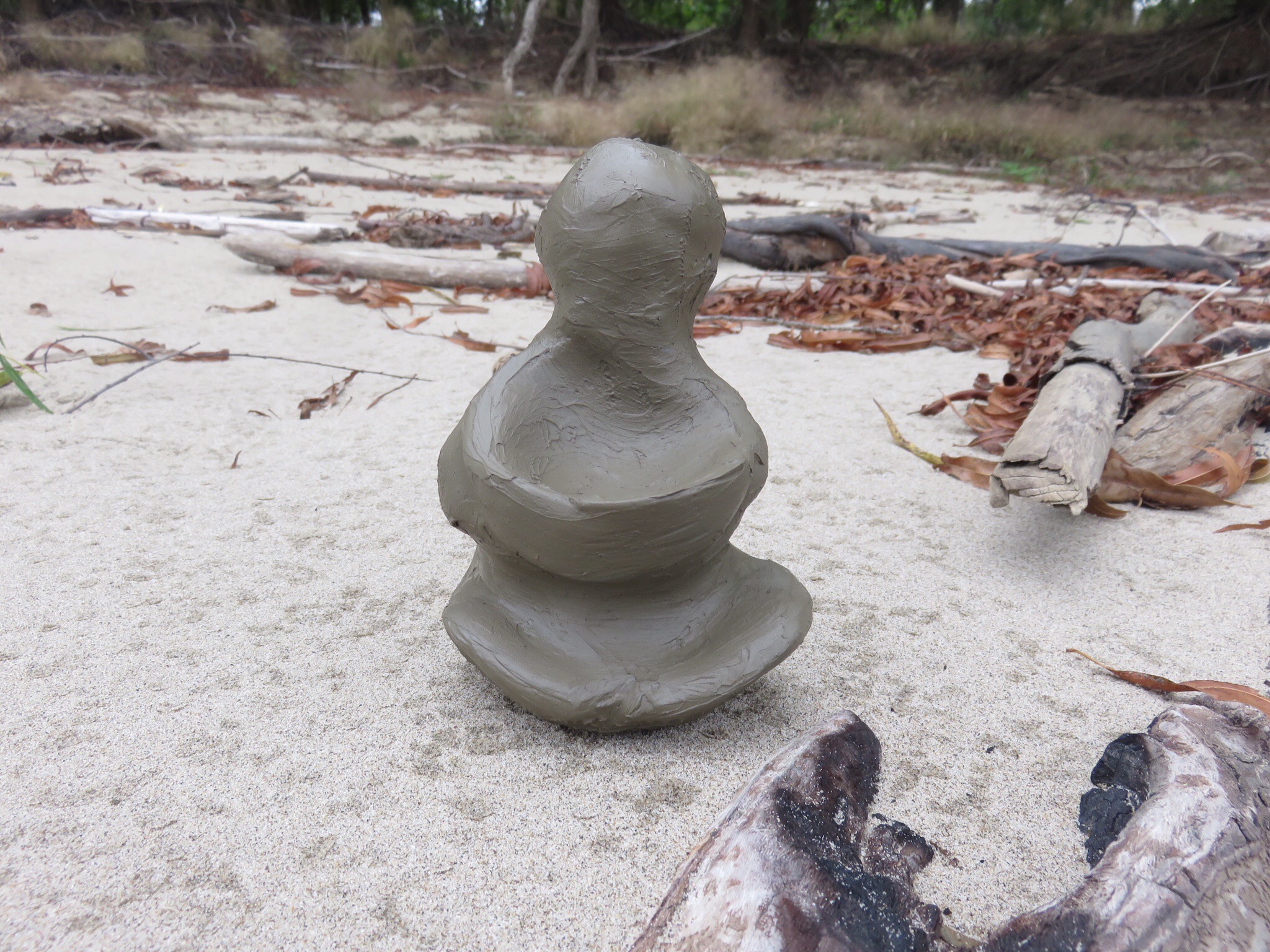
Kyle has made a unique and awesome jug out of a glass bottle and ropes he found along the river. He took the glass bottle, cleaned all the sand and river water from it, and then used the line he found wrapped up in a tree weeks ago to tie around the bottle. It turned out to be a really cool little jug, particularly because the entire thing has been made from recycled garbage along the river. The only thing that is missing is a cork. Right now we are using a carved piece of wood, but it isn’t porous enough and leaks a bit. Therefore, we have been on the search for a cork of some kind. Halfway back from the vast stone beach Kyle turned to me and pointed “Let’s walk down to the river’s edge where all those stones are and see if we can find a cork.” Looking at the shelve of mud that separated me from the water’s edge I agreed and we attempted to walk, very lightly, on the mud. We both failed. Our feet quickly sank into the brown wet mud and we giggled as it squeezed in between our toes very similar to a play dough dispenser. “This was a great idea!” I said half serious as the mud began squirting up and covering my legs. Being that I was already covered I decided to just go for it, and intentionally chose the gooiest looking areas to see how far I would sink. Somewhere along the way Kyle found a large chunk of muddy clay. He was very fascinated and focused on this discovery so I continued walking. Once he caught up he held is clearly very muddy hands behind his back. “Look!” A smiling forming under his blonde mustache. Proudly he held up an actually quite impressive sculpture of a woman holding a basket. He rested it in his muddy palm and I observed the sculpture while the mud began to dry turning from a brown to a grey, showing the lines in his hands intricately.
Arriving back at camp Kyle made bean and cheese quesadillas while I organized all the noisy treasures in my pocket. It is now about 3:15 and I find myself sitting in my camp chair, feet covered in sand, typing on top of a perfectly round and flat tree stump. I love all the natural tables we find out here on the river. I look up at the sky, hoping that it doesn’t bring too much more rain. I have a date tonight! Kyle and I are going to pack up our small backpack with my tiny backpacking stove, dinner supplies, something to drink, and our colorful tapestry to sit on. We are then going to walk back to the openness we found a mile down the beach and have a picnic on the vast covering of stones. It’s been a fabulous day of exploring while waiting out rain and grey skies. Tomorrow will bring sunshine and north winds as we travel the 26 miles into the town of Helena, Arkansas to resupply and do more research on our new route plan.

Speaking of a new route, The Atchafalaya River. Who knew it existed?! Not me and my goodness am I grateful it does! Just before the city of Baton Rouge at mile 307 on the Lower Mississippi River there is a right hand turn. Most river travelers continue straight past the right hand turn and into the cities of Baton Rouge and eventually New Orleans. Well considering Baton Rouge/New Orleans Harbor is the busiest inland port in the United States and someone told me, the world, I have pretty much been dreading it. But with this new discovery of the Atchafalaya River we have no worries! If we make this right hand turn at mile 307 we will be greeted with a Lock and Dam, once passing through the Lock and Dam there is a 6 mile canal, and then we are free. In front of us we will 150 miles of river leading to the Gulf of Mexico! And what is so exciting about this discovery is that the Atchafalaya is actually the Mississippi! If the river were allowed to do what it wanted, without human intervention, the Mississippi would turn right and follow this 150 miles stretch to the Gulf. Therefore Kyle and I both are feeling very excited not only to skip the ridiculous industry of the Baton Rouge/New Orleans area, but that we are going with the natural flow of the mighty river. Based on our estimations we will be reaching the Gulf of Mexico in about 3 weeks. We are both so thrilled to find salt water and open bodies of water! We will enjoy these next few weeks immensely as we prepare to start a new stretch of our journey 🙂 Onward!
P.S. The stretches between towns and Internet are getting longer. Bear with me as I do my best to keep the weekly updates!

I understand you guys find trash and items the surely should be disposed of properly, but the Mississippi also had devastating floods that have destroyed homes as recently as 2012 is believe.
LikeLiked by 1 person
That’s a very good point. Plastic just bums us out because it’ll be there for so long. But I agree, the flooding of homes is very different than littering.
LikeLike
You realize, of course, that the Atchafalaya route to the Gulf will deposit you (quite literally) in Morgan City, La – over 100 miles west of New Orleans – and still some 20 miles short of the Gulf. That said, you will find fine folks in Morgan City (Cajun Country, BTW). Also keep in mind that the Morgan City area is covered by VTS just like Baton Rouge to NOLA. You will need that radio to stay in touch with VTS in a very high traffic area where the Atchafalaya croosed the Gulf IntraCoastal Canal. I know the port director in Morgan City (Mac Wade) as well as his staff. I’ll be watching your progress and let them know you are coming. That may amount to nothing, but you never know.
LikeLiked by 1 person
Hi Chuck, thanks so much for all the info and thought! We are aware of the Atchafayla taking us West rather than east, but five miles of really busy traffic and 100 miles of intermediate traffic with swamp and trees to camp in the boat in, sounds much better than 300 miles of mostly industry and even some plastic plants with limited camping. We will have our radio on and will make sure to communicate with the tugs. We usually talk to at least one or two a day now, and they have all been very kind. It will be a different adventure full of new challenges and that’s why we chose it. We really appreciate the information and will use it wisely. -D & K
LikeLike